Fort Point Trail
Status
Update March 2024 - There has been some damage to the trail due to the heavy rains. This is not entirely unexpected and the contractor will be out this spring to do all repairs and necessary regrading so this does not happen again. One section in particular may now be difficult for wheeled carraiges or wheelchairs.
The Fort Point trail is now open to foot traffic only. Bicycles and motorized vehicles are not allowed as they would damage the trail.
Highlights
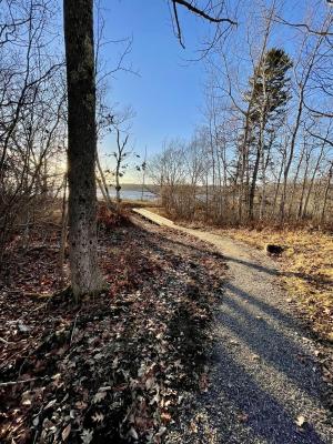
A short hike thru mixed woods to the remnants of the historic Fort St. George with stunning views both up and down the St George River.
Trail Description
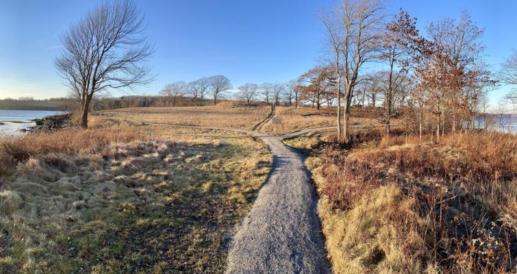
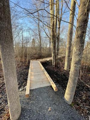
The Fort Point trail is a Universal Access trail. It consists of a hard packed 3' wide surface and 5 cedar boardwalks to traverse wet areas. The trail begins to the left of the trailhead kiosk, winding through an open field of goldenrod, steeplebush, and sensitive ferns bordered by an alder thicket. It then enters mixed evergreen/deciduous woods and crosses a small stream via a 48' cedar timber bridge. In the spring, trout lilies bloom in abundance here, along with other northern woodland flowers such as bunchberry, Canada mayflower, and starflower. Descending gently from this point, mature maple, ash, cherry, and white birch dominate the canopy until the trail opens into field. The Fort remnants are to the left and center of the small peninsula, where an earthen mound is visible. The Point offers 180 degree views of the St. George River.
Activities
Walking, hiking, dogs on leash, birding, access to Fort Point and picnic tables.
Not Allowed
Mountain bikes, motorized vehicles, camping
Please Leave No Trace
Please pack out all trash and clean up after your dog.
Directions and Parking
From the intersection of Route 1 and 131 in Thomaston, travel approximately five miles south on Route 131 and turn right onto Wiley’s Corner road followed by an immediate right onto a gravel access road and parking area. From Watts Avenue in Tenants Harbor, travel north on Route 131approximately 4.7 miles to Wiley’s corner.
Level of Difficulty
Easy
Trail length
Three quarters of a mile (round trip)
- Click here for trail map
- Click here for trail volunteer opportunities
- Click here to email Conservation Commission with trail comments
Notes: The Historic Fort Point Trail is a collaboration between the St. George Conservation Commission and the Georges River Land Trust and maintained by volunteer efforts. The trail is open from sunrise to sunset and restricted to hiking only.